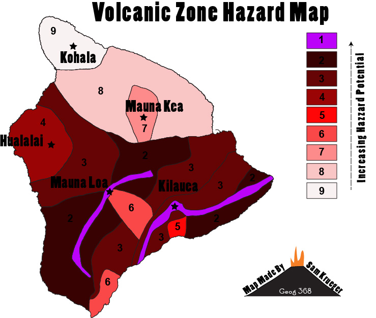
Figure 1. Volcanic hazard map outlining 9 zones of hazard potential on the Big Island. Zone data provided by the Hawai`i state GIS program. Map by Sam Krueger
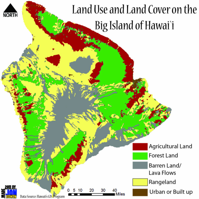
Figure 2. The varying environmental conditions throughout Hawai`i allow for a large variety of land cover and uses associated with those covers. Map by Jon Bowen
Sources
2011. State GIS Program State of Hawai`i. Retrieved December 14, 2011 (http://hawaii.gov/dbedt/gis/).
Banner Photo by Beth Amann
Banner Photo by Beth Amann
