Stop 6 Hōlei Sea ArchSea arches and sea stacks are common physical features inhabiting the coastlines of Hawai`i. These erosional structures form when aggressive Pacific tidal waves pound weak coastlines which then erode, leaving behind artistic rock sculptures. Although these features are very common in the coastal landscape around Hawai`i, they are not always reachable for sight-seeing.
The very accessible Hōlei Sea Arch stands near the end of the Chain of Craters Road at mile marker 20 (refer to Figure 2). This arch is composed of igneous basalt and is just a few hundred years old. The formation of the Hōlei arch can be attributed to years of seaborne weathering that eroded a weak layer of underlying bedrock (refer to Figure 19). Cliffs accompanying the Hōlei sea arch range from 80 to 100 feet tall (MacGowan, 2008). Tidal sprays can still reach the cliff surface so it is advised to tread carefully and watch your step! 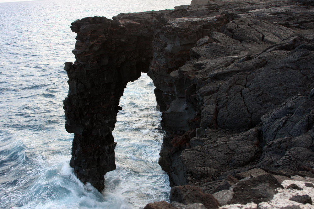
Figure 19. The Hōlei Sea Arch formed from years of seaborne weathering on a weak basalt coastline. (Photo by Ross Auna)
Pu'u ō’ōPu'u ō’ō is currently the most eruptive cinder cone in Hawai`i Volcanoes National Park. Since 1983, the Pu'u ō’ō vent has been spewing lava from the eastern rift zone of Kilauea (refer to Figure 21). At one time, the Chain of Craters Road passed through the city of Kalapana and linked Hawai`i Volcanoes National Park to Hilo. Years of continual lava flow from the Pu'u ō’ō has since blanketed approximately 8 miles of road.
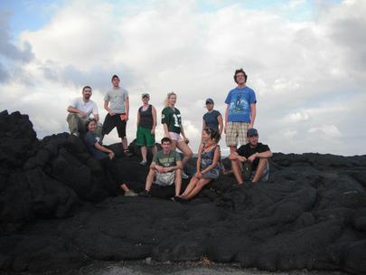
Figure 20. We sat on a lava flow younger than us! This lava field was created from 1994 lava flows from Pu'u ō’ō. (Photo by Ezra Zeitler)
|
Recent Pu'u ō’ō Activity2007- At the beginning of 2007, total lava flows from Pu'u ō’ō had covered over 45 square miles of land and created over 500 acres of new land in southern Hawai`i. The new land growth has been accompanied by a significant degree of collateral damage as 189 buildings have been destroyed and over 8 miles of highway has permanently been closed. Earthquakes in 2007 caused a collapsed in the crater floor of Pu`u ō`ō. As a result of this seismic activity, a‘a lava flows emerged from vents in the northeast rift zone and began pouring down southern and eastern flanks of Kilauea.
2008- Lava flows began to spew from eastern vents in July of 2008 until a number of new vents opened up in the Royal Gardens area in October. By November of 2008, the active fissures in the Royal Gardens sent a substantial amount of lava flow to the coast were large portions of land were covered. 2011- In early March of 2011, the floor of Pu`u ō`ō once again collapsed and lava began erupting from the east rift zone between Pu'u ō’ō and Nāpau Crater. Lava then started to refill Pu`u ō`ō as of late March. The next series of eruptive events in Pu`u ō`ō occurred in late September as fissures on the east and southeast flank began discharging walls of a`a flow. Much smaller flows were visable West of the Pu`u ō`ō crater. For updated volcanic conditions in Kilauea, visit the Hawaiian Volcano Observatory to learn more. 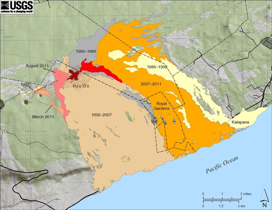
Figure 21. Since 1983 the Pu'u ō'ō cinder cone on Kilauea's east rift zone has continually been spewing lava along the southern and eastern flanks of the volcano. (Illustration by USGS)
|
Sources
MacGowan, Donald. 2008. “Hōlei Sea Arch, Hawaii Volcanoes National Park.” Loving The Big Island Webblog. Retrieved November 9,
2011 (http://lovingthebigisland.wordpress.com/2010/03/11/exploring-hawaii-volcanoes-national-park-holei-sea-arch/).
2011. "Kilauea's East Rift Zone Eruption 1983-Present." USGS. Retrieved November 7, 2011 (http://hvo.wr.usgs.gov/kilauea/summary/)
Wikipedia contributors, "Puʻu ʻŌʻō" Wikipedia, The Free Encyclopedia. Retrieved November 7, 2011 (http://en.wikipedia.org/wiki/Pu%CA%BBu_%CA%BBC5%8C%CA%BB%C5%8D).
Banner photo by Elizabeth Amann
