|
Mauna Loa (Long Mountain)
Mauna Loa is one of the largest shield volcanos in the world. It was created by millions of years of relatively non-volcanic eruptions originating in the hotspot located beneath Hawai`i. These eruptions created a very fluid lava that have slowly contributed to the minimal slope that a shield volcano exhibits. Today these eruptions are quite limited because Mauna Loa is in the end of its shield stage. From 1843-1995 Mauna Loa has only erupted 36 times, with 3 being in the past 50 years. The most eruption was in 1984. The volume of lava Mauna Loa is enormous and has a volume of about 10,000 cubic miles. Compared to it's nearest neighbor, Mauna Kea, Mauna Loa is only about 120 feet lower in elevation. The caldera of Mauna Loa has spiritual significance for the locals on Hawai`i. Called Mokuāweoweo, the caldera in ancient times had a small trail leading to the top that people would bring offerings to Pele, the goddess of fire. There is a historic trail called Ainapo trail that the natives used to take to the caldera. This trail was also used by future haoles to get to the top. It is no longer accessible due to maintenance issues. Climate Climate atop Mauna Loa is considered a tropical highland with relatively cool temperatures. The temperature in Kona was 75° F at sea level but dipped to a cool 45° F atop Mauna Loa. Scientific Background The Mauna Loa Observatory was opened June 28th, 1956 by the National Oceanic and Atmospheric Administration. Due to the changing elements of the atmosphere its intent is to monitor various factors that are or are potentially related to climate change. This is a prime spot for this type of observation because it is located above the temperature inversion layer that exists on Hawai`i allowing the samples to be taken well away from major pollutants. The MLO is also the located where Dr. Charles Keeling captured his largest collection of CO2 samples dating back to 1958. His curve later became known as the “Keeling Curve” and had worldwide impacts. It is the major piece of data that scientists and theorists have used to support cases of a growing pattern of global warming. |
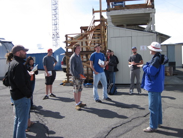
Figure 8. Our class recieved a brief overview from John Barnes before our tour of the MLO facility. (Photo by Doug Faulkner)
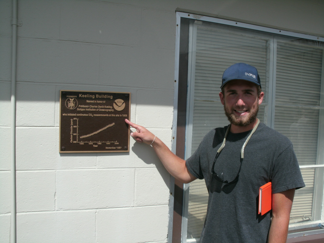
Figure 9. The Keeling Curve is now a plaque on the outside of the MLO in memory of Dr. Keeling. (Photo by Jon Bowen)
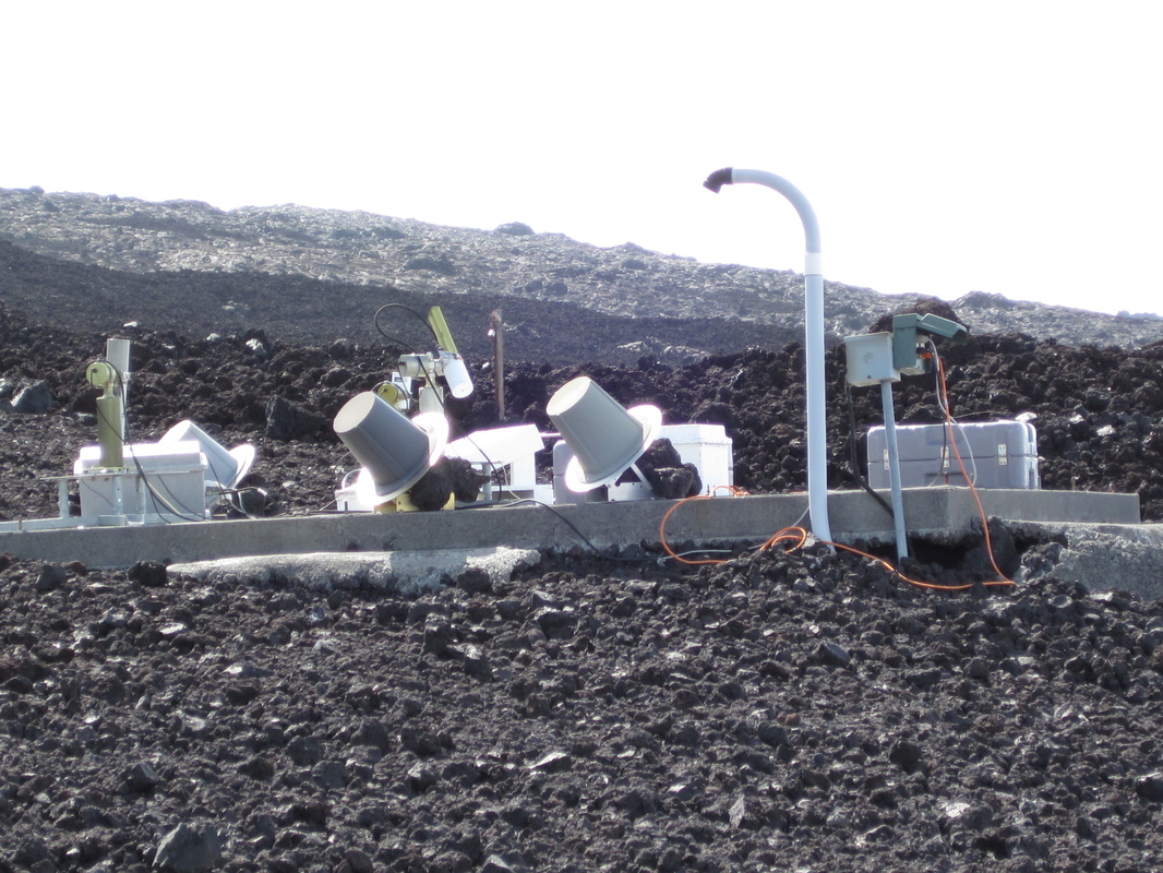
Figure 10. Various instruments used and maintained by the United States Weather Service. (Photo by Doug Faulkner)
|
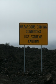
Figure 11. Let's just say, the the MLO road is a little behind on repairs. (Photo by Jon Bowen)
|
After creeping up the winding pot-holed Mauna Loa Access Road we arrived at 3,396m or 11,141 ft. Gazing over the clouds we arrived on what we later found out was a bad day at the MLO. There were a lot of cirrus clouds in the sky and it was a fairly windy day with approx. 10-15mph winds. The lowered oxygen content was also very noticable because the 100 yard walk from the parking lot up to the observatory was extremely exhausting.
|
|
We were lucky enough to meet with John Barnes, a world renowned physical scientist who is currently working on lidar detection programs at the MLO. Barnes gave us an extremely comprehensive tour of the facilities and was the source of a lot of fascinating infomation.
Mauna Loa's rich historical background began with an expedition in 1840 that was launched by the United States and led by Charles Wilkes. Its agenda was to hire porters and make it to the summit in order to gain more knowledge on volcanoes. After a series of logistical errors and nearly month later Wilkes made it to the summit and estimated its height to be 11,334ft which is only 193 feet higher than modern measurements. Despite the trek bringing no new scientific understanding to the mountain, it was considered the first scientific work done on Mauna Loa. Today the Mauna Loa observatory has grown to be funded by NOAA, NASA, Department of Agriculture, Department of Energy, and various national universities. Projects associated with each group range from greenhouse gases, ozone and water vapor, air quality, lidar, trace gases, and halocarbons. Supporting these projects the MLO has over 250 sampling instruments with even more that are brought to get calibrated in the near perfect air quality on top of Mauna Loa. The costs associated with these intruments range from $5,000 to one million dollars. Despite the growing number of programs that the MLO supports, studies on ozone and greenhouses gases are most common. The number one CO2 collection device is a dopson spectrometer (below). Barnes informed us that although the MLO has one of the original dopsons the one on their site is no longer used however many dopsons around the world (total of about 150) are brought here to be calibrated. This facility is constantly changing due to the growing number of programs that want to take samples at this site. It now at a yearly operating cost of approximately 1.5-2 million dollars. Our group asked Barnes how a program determined where to place their equipment. He responded…"although it looks quite scattered, it depends on what the organization wants to study. If their taking samples of gases you may want to put them on the tower, or if their taking light samples their going to need plenty of room for the different angles associated with the sun." As we went shifted from outside to inside we noticed how small of a facility the MLO actually is. We noticed numerous sampling computers ranging from gas intakes coming in on tubes from the tower, to Mercury content in the billions per square foot. Barnes also showed our group a real time CO2 measurement for the exsact time and day in which we were there. |
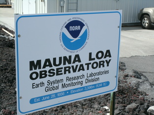
Figure 12. Welcome to the MLO! (Photo by Jon Bowen)
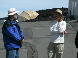
Figure 13. John Barnes (left) and Doug Faulkner (right) chat as we gain new insights to the MLO. (Photo by Jon Bowen)
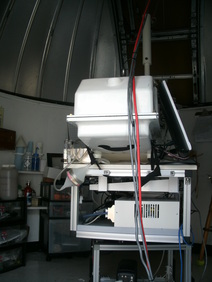
Figure 14. A Dobson ozone collector stands idle due to maintenance issues. Dobsons are now rare because they are no longer made anywhere in the world. (Photo by Jon Bowen)
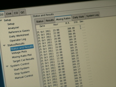
Figure 15. October 25th 2011, CO2 emissions at the MLO are 388ppm. (Photo by Jon Bowen)
|
Sources
Juvik, Sonia P. and Juvik, James O. 1998. Atlas of Hawai‘i.
Hilo, HI: University of Hawai‘i Press
Russell A. Apple. 1973. "Ainapo Trail Nomination form." National Register of Historic Places. National Park Service
Banner Photo by Jon Bowen
Hilo, HI: University of Hawai‘i Press
Russell A. Apple. 1973. "Ainapo Trail Nomination form." National Register of Historic Places. National Park Service
Banner Photo by Jon Bowen
